Wildfire Risk Reduction and Asset Protection Project
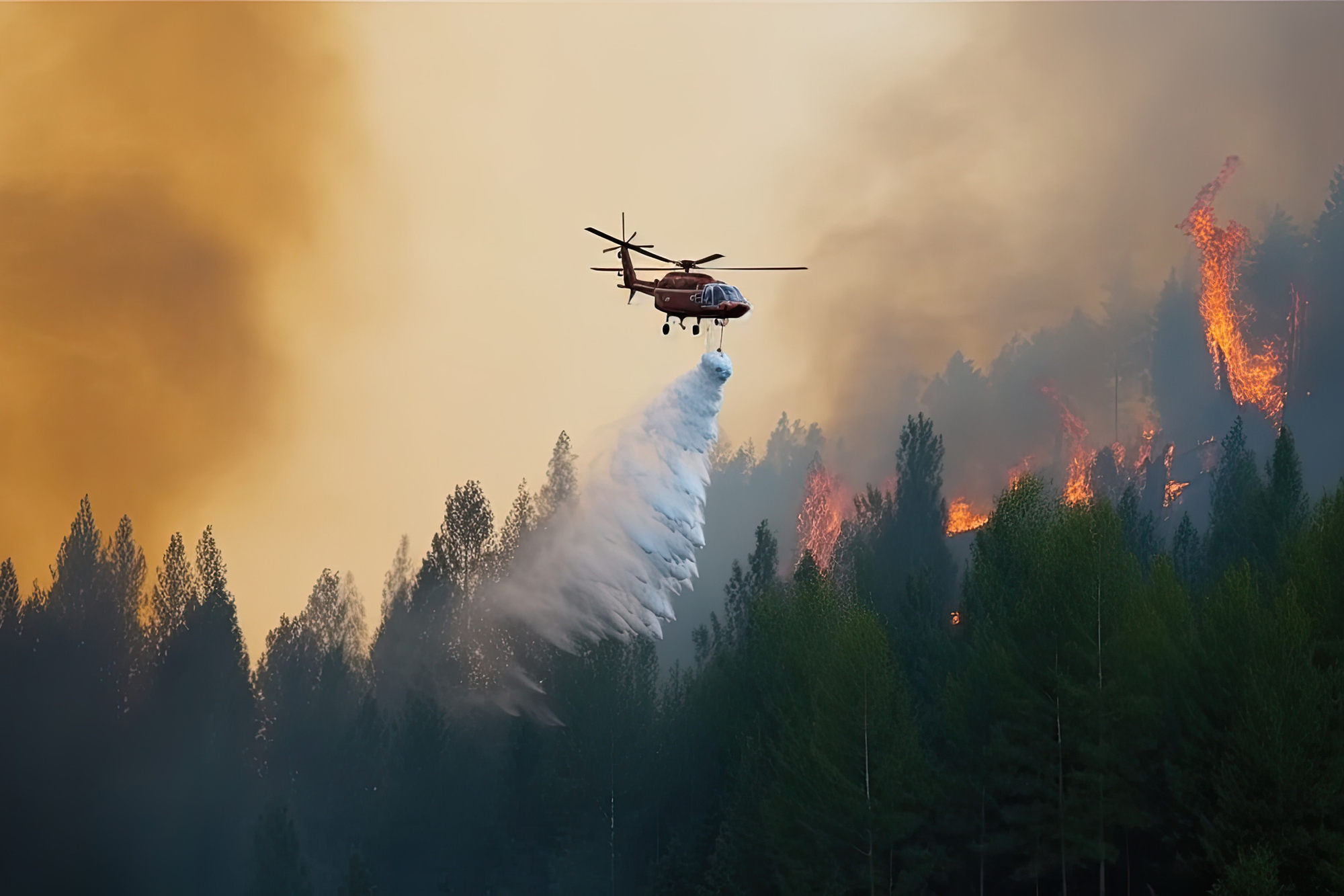
Trinity Public Utilities District (Trinity PUD) is proposing a proactive ROW expansion and vegetation management project to reduce fire risk to the surrounding communities and Public lands, as well as to increase electrical reliability to maintain critical services in the local communities. The areas surrounding Trinity PUD’s system are particularly vulnerable to fire risk due to the dense vegetation and steep terrain. CalFire classifies this area as Very High Fire Hazard, and this risk was manifested in the recent Carr Fire near Whiskeytown National Recreation Area. This project would effectively reduce fuel loads within the ROWs of these utility systems, create a potential firebreak, protect the transmission and distribution system assets, and minimize the risk of a wildfire caused by power lines.
Trinity PUD proposes to expand their utility ROW for its transmission and distribution system. Vegetation would be removed as necessary for risk reduction and reliability purposes. The distance of ROW expansion would be based on the risk-level of each section of utility line. Risk-levels will be based on surrounding vegetation, topography, sensitive resources, urban-setting, and other characteristics.
Frequently Asked Questions
-
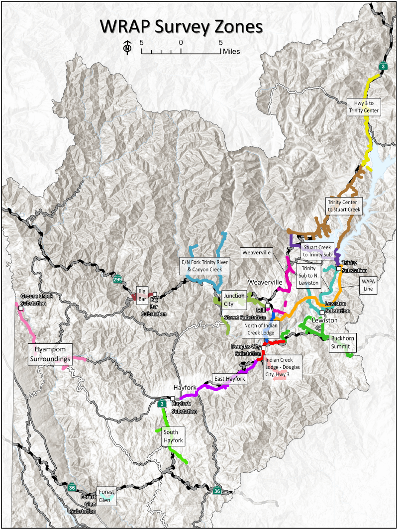
Where is the project?
The project Study Area will include a majority of Trinity PUD’s sub-transmission and distribution lines (see map).
-
What is the schedule?
The project is still in the early planning stages. Resource surveys began in late May and will continue throughout the end of August 2020.
-
Who is involved?
Trinity PUD has contracted with Aspen Environmental Group to assist with the environmental planning portion of the project. Trinity PUD and Aspen have been coordinating with the U.S. Forest Service, Bureau of Land Management, Bureau of Reclamation, and Trinity County regarding this very important wildfire risk reduction project. -
How will this impact my property?
Since the project is in its early planning stages, no final decisions have been made. A survey crew may need access around your property to assess existing conditions. Please notify TPUD if this causes any problems. -
Why is this project important?
Much of Trinity County has been identified as Very High Fire Hazard Risk according to CalFire. Trinity PUD wants to ensure that our utility lines are not contributing to the fire risk in Trinity County. The safety of our community is our top priority.